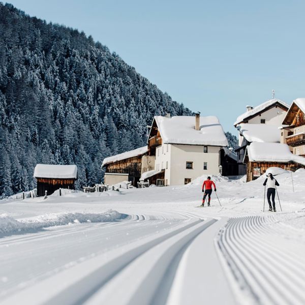
Nauders
Cross-country skiing
Status
Difficulty
Length
Nauders - Langlaufroute Schwarzer See cross-country ski run
closed
Hard
10,000 m
Höhenunterschied: 200 m
Classic high cross-country ski track at the Mutzkopf from the "Tiefer Gatter" to the Schwarzer See
Length: 10 kilometers
Level of difficulty: difficult/black
Differenz of altitude: 138 meters
Length: 10 kilometers
Level of difficulty: difficult/black
Differenz of altitude: 138 meters
✓ prepared
Nauders - Moasloipe cross-country ski run
closed
Medium
8,000 m
Höhenunterschied: 140 m
The Moas high-altitude trail runs through a very beautiful forest landscape from the Norbertshöhe to the Pflanzgarten and back again. The trail is exposed to rougher terrain and therefore technically more demanding to run. However, the scenic view of the Engadine compensates for this. Stop for refreshments at the Gasthof Norbertshöhe.
✓ prepared
Nauders Reschenloipe cross-country ski run
closed
Medium
6,500 m
The Reschen circular trail, which can be combined several times, is very attractive for cross-country skiers.
You can start from Gasthof Martha via the Libaneresloipe, which then joins the Reschenloipe at the valley station, or you can start directly at the valley station. The trail leads across the slightly hilly Arsang meadows in the direction of Fuhrmannsloch. With a short ascent and equally long descent, you run to the border. Here you can cross the federal road and continue to the Reschensee lake, where the church tower of Alt-Graun, juts out of the ice. There are refreshment stops right at the national border.
You can start from Gasthof Martha via the Libaneresloipe, which then joins the Reschenloipe at the valley station, or you can start directly at the valley station. The trail leads across the slightly hilly Arsang meadows in the direction of Fuhrmannsloch. With a short ascent and equally long descent, you run to the border. Here you can cross the federal road and continue to the Reschensee lake, where the church tower of Alt-Graun, juts out of the ice. There are refreshment stops right at the national border.
✓ prepared
Nauders Libaneresloipe cross-country ski run
closed
Medium
3,000 m
The Libaneresloipe leads from the edge of the village to the valley station and back again. From the valley station you can join other trails. The trail is the perfect circular route with one or two slight ascents and descents. Refreshment stops: Gasthof Martha or Restaurant Arsangs at the valley station.
Tip: The best way to get to the start is on foot via Alte Straße past Naudersberg Castle in the direction of the valley station / Gasthof Martha or via the Oberdorf connecting trail.
Tip: The best way to get to the start is on foot via Alte Straße past Naudersberg Castle in the direction of the valley station / Gasthof Martha or via the Oberdorf connecting trail.
✓ prepared
Nauders Arsangsloipe cross-country ski run
closed
Easy
3,500 m
Nauders am Reschenpass and the valley station of the Bergkastelseilbahn are reachable with the public bus.
✓ prepared
Resia/Reschen
Cross-country skiing
Status
Difficulty
Length
Reschen - Reschenseetrail
closed
Medium
9,000 m
From the lakeside "Gandlan" over flat meadow area at Altdorf and the Pofellift over. After 300m it comes down to the border. From there you have the opportunity to continue across to Nauders or loops back to Reschen. Difference in altitude: 45 m Difficulty: easy
A really "unlimited" Cross-Country Fun offers the three-country ski trail between Italy and Austria to Switzerland!
✓ prepared
Vallelunga/Langtaufers
Cross-country skiing
Status
Difficulty
Length
Langtaufers - Ski trail Weisskugel
closed
Easy
5,000 m
The cross-country ski trail in wintry Langtaufers leads along the picturesque Karlin stream and offers a breathtaking view of the majestic Weisskugel glacier. The trail is well marked and groomed and offers cross-country skiers of all levels a route of about 5 km. On the way, there is the opportunity to stop at the cosy Melager Alm and fortify yourself with traditional South Tyrolean specialities. The trail offers gentle terrain and guarantees cross-country skiers an unforgettable experience in the magical winter landscape of the Langtauferertal valley
The cross-country ski trail section and the winter hiking trail from Melag to Melager Alm is closed due to the current situation.
✓ prepared
Langtaufers - Ski Trail Karlin
closed
Easy
4,500 m
The cross-country skiing trail in the Langtauferer Valley runs alongside the Karlin river and offers a breathtaking backdrop of snow-capped mountains and forests. The trail is ideal for skiers of all levels and offers a route of approximately 4,5 km. The trail is well-marked and prepared, and offers gentle terrain with some light inclines and descents. Skiers can enjoy the beauty of nature and breathe in the fresh mountain air while exploring the trail
The cross-country ski trail section and the winter hiking trail from Melag to Melager Alm is closed due to the current situation.
✓ prepared
Langtaufers - Ski Track La Venosta
closed
Medium
7,500 m
The cross-country skiing trail in the winter wonderland of Langtauferers is the same route as the cross-country skiing competition for the Ski Classics series La Venosta. On this approximately 7 km long route, cross-country skiers can feel like professionals and tackle the challenge of the demanding terrain. The trail is well-marked and prepared and offers terrain with some steep inclines and descents that demand the most effort from athletes. The trail also offers a stunning view of the snow-capped mountains and forests of the Langtauferer Tal. The cross-country skiing trail promises an unforgettable experience for anyone seeking a challenge and wanting to feel like world-class skiers
The cross-country ski trail section and the winter hiking trail from Melag to Melager Alm is closed due to the current situation.
✓ prepared
Solda/Sulden
Cross-country skiing
Status
Difficulty
Length
High-Altitude Cross-Country Skiing Trail in Solda/Sulden
closed
Easy
4,800 m
Next to the chairlift Kanzel
✓ lighted up
✓ prepared
Slingia/Schlinig
Cross-country skiing
Status
Difficulty
Length
Nordic center Slingia
closed
Easy
22,000 m
Cross country skiing is an intensive and relaxing experience in the unspoiled nature. The sunny Slingia valley welcomes you with perfectly preapred slopes. Beginners and professionales find best conditions on 22 km slopes.
✓ prepared
Trail Sesvenna
closed
Medium
6,090 m
At Burgusio you have to go in direction Slingia. At Slingia you have to go straight ahead until after the church. There you have to take the street at the left side and you have to go again straight ahead until you are in front of the Nordic Slingia.
✓ prepared
Trail Fölla
closed
Easy
4,023 m
The Fölla trail is a classic and skating trail in the cross-country skiing centre of Schlinig.
Length: 4 km
Metres in altitude uphill: 70 m
Level of difficulty: easy/blue
✓ prepared
Alpine pasture trail
closed
Hard
9,170 m
At Burgusio you have to go in direction Slingia. At Slingia you have to go straight ahead until after the church. There you have to take the street at the left side and you have to go again straight ahead until you are in front of the Nordic Slingia.
✓ prepared
Trail Rasass
closed
Easy
2,473 m
The Rasass trail is a classic and skating trail in the cross-country skiing centre of Schlinig.
Length: 2 km
Metres in altitude uphill: 30 m
Level of difficulty: easy/blue
✓ prepared
Trail Monterodes
closed
Easy
1,120 m
The Monterodes trail is a classic and skating trail in the cross-country skiing centre of Schlinig.
Length: 1 km
Metres in altitude uphill: 15 m
Level of difficulty: easy/blue
✓ prepared
Val Martello Valley
Cross-country skiing
Status
Difficulty
Length
Val Martello - cross-country ski run Santa Maria alla Fonderia
closed
Medium
3,000 m
Höhenunterschied: 110 m
The starting point of this pleasant cross-country ski trail is Hotel Waldheim. The chapel of Santa Maria alla Fonderia built in 1711 is situated along the trail and is definitely worth a stop. Of course you can also walk to the chapel.
Martello - Track Biathlon center 4 kilometers
closed
Hard
3,700 m
Applies to all trails in the biathlon center: suitable for classic and skating
Starting point: at the Biathlon Center Grogg from 1700 m
1 km:
Largely flat trail, without technically difficult climbs and descents. Ideal for beginners. Difference in altitude: 20 m
2 km:
The 2 km loop leads from the biathlon stadium first 1km flat along the orographically left side of the Plima, where you then immediately turn right. After another flat passage, a steep and demanding climb follows. After that, the trail is flat again until the snow depot, where an easy descent follows. Then you run flat again with two short crisp climbs towards the biathlon stadium.
Height difference: 50 m
3,3 km:
Challenging loop with the legendary Fragolino, which with its long climb and technically difficult descent, is one of the most difficult sections in the biathlon circuit.
Recommended only for advanced cross-country skiers!
Height difference: 60 m
4 km:
The longest loop in the biathlon center for advanced cross-country skiers with technically challenging climbs and descents, but also flat gliding sections.
Height difference: 60 m
Martello - Track bitahlon center 3 kilometers
closed
Hard
2,926 m
Applies to all trails in the biathlon center: suitable for classic and skating
Starting point: at the Biathlon Center Grogg from 1700 m
Challenging loop with the legendary Fragolino, which with its long climb and technically difficult descent, is one of the most difficult sections in the biathlon circuit.
Recommended only for advanced cross-country skiers! Height difference: 60 m
Martello - Track St. Maria in der Schmelz 2 kilometers
closed
Easy
1,846 m
The cross-country skiing trail in Schmelz, starting at the Hotel Waldheim at 1520m, is a forest hiking trail. Here it is allowed to hike on the cross-country trail, to go sledding and dogs are also allowed, but must be kept on a leash.
Please give priority to cross-country skiers!
Val Martello - cross-country ski run biathlon center "Grogg"
closed
Medium
2,092 m
At the biathlon centre in Martello/Martell located at an altitude of 1.700 m in a breathtaking winter landscape, there are cross-country skiing trails of different lenghts and of various degrees of difficulty.
At the biathlon centre Martello/Martell, biathles of different national teams train every year and international and national biathlon competitions are organized regularly. In addition, the centre also has a modern shooting range with 27 fully automatic firing ranges.
At the biathlon centre Martello/Martell, biathles of different national teams train every year and international and national biathlon competitions are organized regularly. In addition, the centre also has a modern shooting range with 27 fully automatic firing ranges.
✓ lighted up
✓ prepared
Martello - Track St. Maria in der Schmelz 3 chilometri
closed
Medium
4,189 m
The cross-country skiing trail in Schmelz, starting at the Hotel Waldheim at 1520m, is a forest hiking trail. Here it is allowed to hike on the cross-country trail, to go sledding and dogs are also allowed, but must be kept on a leash.
Please give priority to cross-country skiers!
Martello - Track St. Maria in der Schmelz 1 kilometer
closed
Easy
1,204 m
The cross-country skiing trail in Schmelz, starting at the Hotel Waldheim at 1520m, is a forest hiking trail. Here it is allowed to hike on the cross-country trail, to go sledding and dogs are also allowed, but must be kept on a leash.
Please give priority to cross-country skiers!
Martello - Track biarhlon center 2 kilometers
closed
Medium
2,092 m
Applies to all trails in the biathlon center: suitable for classic and skating
Starting point: at the Biathlon Center Grogg from 1700 m
The 2 km loop leads from the biathlon stadium first 1km flat along the orographically left side of the Plima, where you then immediately turn right. After another flat passage, a steep and demanding climb follows. After that, the trail is flat again until the snow depot, where an easy descent follows. Then you run flat again with two short crisp climbs towards the biathlon stadium.
Height difference: 50 m
Val Müstair
Cross-country skiing
Status
Difficulty
Length
Rundloipe "La pretensiusa" - Fuldera
closed
Medium
4,000 m
Langlaufloipe Furom - Fuldera d'Aint - Furom.
Panoramaloipe "La sulagliva" - Lü
closed
Hard
2,750 m
Langlaufloipe Lü
Lü trail can no longer be prepared continuously (lack of snow)
Höhenloipe "La muntagnarda" - Minschuns
closed
Hard
2,969 m
Harmonisch kupiertes Gelände und beeindruckender Arvenwald. Die Chancen, Wild zu beobachten, sind hier besonders gross.
Einstieg bei der Talstation des Skilifts, Aufstieg entlang der Skipiste ca. 5 Min. bis zum Loipenbeginn. Die Höhenloipe wird auch als Winterwanderweg gespurt. Dank der Höhenlage ist diese Loipe besonders schneesicher.
Rundloipe "La mezdauna"
closed
Medium
2,600 m
Langlaufloipe Palüds in Fuldera d'Aint.
Talloipe "La vallada" - Valchava bis Furom
closed
Medium
8,705 m
Höhenunterschied: 339 m
Langlaufen in der Heimat von Olympiasieger Dario Cologna: Die Loipe zwischen Tschierv und Valchava schlängelt sich in einer angenehmen Steigung abwechslungsweise durch Tannen- und Lärchenwälder dem malerischen Rombach entlang.
Das Val Müstair, Heimat von Langlauf-Superstar Dario Cologna und seinem Bruder Gianluca, liegt in der südöstlichsten Ecke Graubündens und erstreckt sich zwischen dem Ofenpass und dem italienischen Vinschgau. Auch dank der Popularität der Cologna-Brüder mausert sich das Gebiet immer mehr zum Langlauf-Eldorado.Die anspruchsvolle Talloipe startet in Valchava. Bei Fuldera führt die Spur durch den Wald und dann weiter über die Ebene von Palüds. Stets dem malerischen Rombach entlang, geht es bis nach Tschierv. Der Einstieg ist in Valchava, Fuldera und Tschierv möglich.Regelmässig gastiert die Tour de Ski, ein Wettbewerb im Skilanglauf über mehrere Tage, im Val Müstair. Für besonders Hartgesottene bietet die «Tour de Ski»-Loipe zum Schluss in Tschierv den Höhepunkt eines perfekten Langlauftags. Die Loipe ist hier besonders steil und anspruchsvoll.
Buffalora cross-country ski trail near the Ofen Pass
closed
Hard
2,975 m
The cross-country ski trail in Buffalora offers a unique, dreamlike landscape setting - Canada sends its regards - with a view of an area covered in deep snow.
Kunstschneeloipe "La artificiala" - Furom in Fuldera
closed
Easy
2,500 m
Einstieg in in Furom beim Langlaufzentrum.
Talloipe "La vallada" - Furom bis Tschierv
closed
Medium
8,705 m
Höhenunterschied: 339 m
Einstieg in Valchava oder Tschirv.
Rundloipe "La pitschna" - Palüds in Fuldera
closed
Easy
1,500 m
Die Perfekte Rundloipe für Anfänger
Die Loipe führt am Bach vorbei. Geniessen Sie die herrliche Aussicht auf dieser leichten Rundloipe.
Rundloipe "La sumbrivainta" - Furom
closed
Hard
3,400 m
Die Loipe führt vom Langlaufzentrum Furom oberhalb Richtung Valchava und wieder zurück.
Rundloipe "Tour de Ski" - Tschierv
closed
Hard
751 m
Die einzigartige Weltcupstrecke ist in Tschierv für alle Langläufer/innen während der Wintersaison offen. Nutzen Sie die Chance und laufen Sie auf der Originalstrecke der Tour de Ski Etappe in Tschierv, auf der sich die Langlaufelite misst.
Rundloipe "La gronda" - Palüds in Fuldera
closed
Medium
2,912 m
Einstieg Fuldera d'Aint.