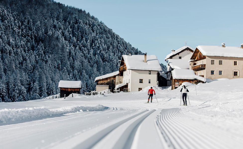
The cross-country skiing area Vallelunga/Langtaufers Valley (IT)
The high-altitude cross-country skiing trail of Vallelunga/Langtaufers Valley in the Venosta Valley
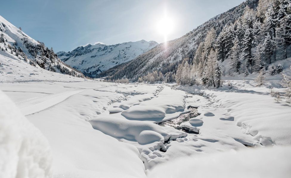
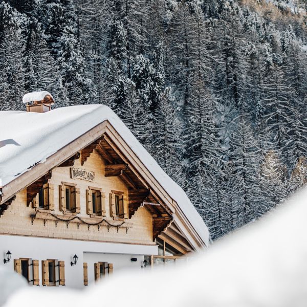
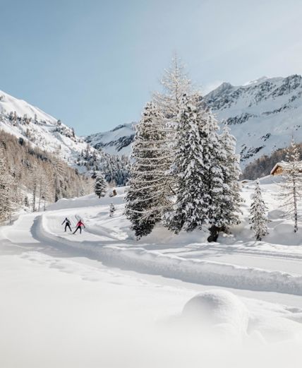
At the back end of the Vallelunga/Langtaufers Valley lies the hamlet of Melago/Melag, at the start of the high-altitude cross-country skiing track. Negotiable either in classic cross-country or free style, Vallelunga/Langtaufers Valley offers various circuits. One of these leads alongside the Karlinbach stream running through the Zirmwald forest that exudes a fresh and spicy mountain fragrance. Offering hot drinks and homemade food, the nearby Melager Alm hut refuge affords skiers the opportunity of a welcome rest stop. At an elevation of 1,912 m and with its ever-present winter snow, this cross-country ski trail remains open from November to April.
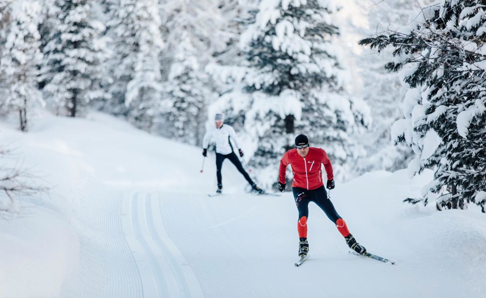
Used by Nordic winter athletes, recreational sports enthusiasts, as well as professional skiers, the Vallelunga/Langtaufers Valley cross-country skiing trails are suited to the less experienced as well as seasoned professionals. "La Venosta", a popular annual cross-country winter event, is also staged here.
Cross-country skiing trails in Vallelunga/Langtaufers Valley
General description National and international competitions take place on this diverse, high-altitude trail at a height of 1912 m. The entrance to the trail is located at the large car park in Melago/Melag. The trail can be used by classic and freestyle cross-country skiers. Refreshments are located close to the car park, warm up with a hot drink at “Evi's Hittl” tavern. Toilets and a changing room are also available here.
The small circular route leads from where the Melager Bach river stream joins the Karlinbach river via a trail back to Melago/Melag. The big circular route heads further out of the valley through the forest to Grub. The trail switches to the other side of the valley and returns across sunny meadows back to Melago/Melag. Continuing along the northern slope of the valley, the trail leads to the Melager Alm hut (1,970 m). This is also open in winter and offers you a rest and the hut owner the chance to spoil you with South Tyrolean delicacies.
Route description On the Venosta Valley road SS40 to Curon/Graun. Continue on the main road from Vallelunga Valley to the parking lot at Melago/Melag.
Track data
Length
14.5 km
Difficulty
media
Difference in height uphill
250 hm
Difference in height
1960 m
download GPX
General description The cross-country skiing trail in the Vallelunga Valley runs along the picturesque Karlinbach river and offers a breathtaking backdrop of snow-covered mountains and forests. The trail is ideal for cross-country skiers of all levels and offers a distance of about 4.5 km. The trail is well marked and groomed and offers a gentle terrain with some easy climbs and descents. Cross-country skiers can enjoy the beauty of nature and breathe the fresh mountain air while exploring the trail.
Route description On the Venosta Valley road SS40 to Curon/Graun. Continue on the main road from Vallelunga Valley to the parking lot at Melago/Melag.
Track data
Length
4.5 km
Difficulty
easy
Difference in height uphill
69 hm
Difference in height
1948 m
download GPX
General description The cross-country skiing trail in the wintry Vallelunga Valley is the same route as the race course for the cross-country competition of the Ski Classics series La Venosta. On this approximately 7 km long track, cross-country skiers can feel like the pros and master the challenge of the demanding course. The trail is well marked and prepared and offers terrain with some steep climbs and descents that demand everything from the athletes. The route also offers a magnificent view of the snow-covered mountains and forests of the Vallelunga Valley. The cross-country ski trail promises an unforgettable experience for all those who are looking for a challenge and want to feel like world-class cross-country skiers.
Route description On the Venosta Valley road SS40 to Curon/Graun. Continue on the main road from Vallelunga Valley to the parking lot at Melago/Melag.
Track data
Length
7.4 km
Difficulty
medium
Difference in height uphill
153 hm
Difference in height
1907 m
download GPX
General description The cross-country skiing trail in wintry Vallelunga Valley leads along the picturesque Karlinbach river and offers a breathtaking view of the majestic Weisskugel glacier. The trail is well marked and groomed and offers cross-country skiers of all levels a route of about 5 km. On the way, there is the opportunity to stop at the cosy Melager Alm hut and fortify yourself with traditional South Tyrolean specialities. The trail offers gentle terrain and guarantees cross-country skiers an unforgettable experience in the magical winter landscape of the Vallelunga Valley.
Route description On the Venosta Valley road SS40 to Curon/Graun. Continue on the main road from Vallelunga Valley to the parking lot at Melago/Melag.
Track data
Length
5 km
Difficulty
easy
Difference in height uphill
85 hm
Difference in height
1947 m
download GPX
Information and service
Resia/Reschen Via Principale 22 IT - 39027 Resia/Reschen T +39 0473 633 101 info@passoresia.it
San Valentino alla Muta/St. Valentin auf der Haide Via Principale 61 IT - 39027 San Valentino alla Muta/St. Valentin auf der Haide T +39 0473 634 603 st.valentin@reschenpass.it
Ski School Reschenpass Via Piz Lun 23 IT - 39024 Malles/Mals T +39 0473 420 751 info@skischule-reschen.it www.ski-reschenpass.com
Sport Tenne Strada Principale 27 IT - 39027 San Valentino alla Muta/St. Valentin auf der Haide T +39 0473 634 722 info@sporttenne.com www.sport-tenne.com
Sport Folie Strada Principale 22 IT - 39027 Resia/Reschen T +39 0473 633 155 info@sport-folie.com www.sport-folie.com
Vacation planning
Accomodation for your cross-country ski holiday in Vallelunga Valley